Abstract
Background :
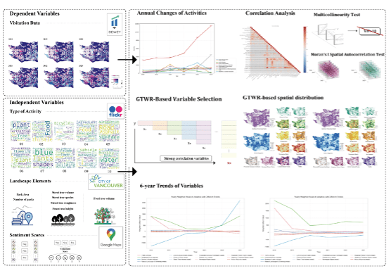
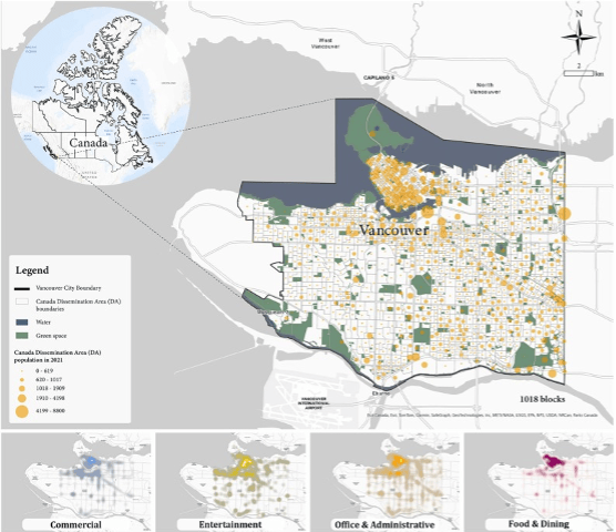
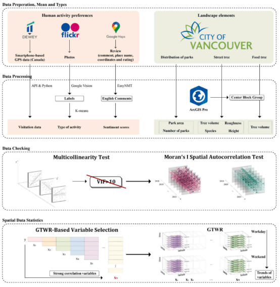
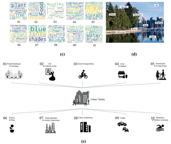
Urban nature, such as street trees, green corridors, and urban parks, plays a central role in promoting human well-being, physical activity, and spatial equity. However, existing studies often evaluate green space in terms of supply (e.g., area, canopy cover) and accessibility, and less so in terms of when, where, and for whom these natural elements enable vitality in urban contexts. Meanwhile, the concept of urban vitality emphasises the intensity, diversity and dynamics of human activity across spatial and temporal scales; and recent advances in social-media and GPS data have opened up new possibilities to track real world urban life in fine detail. This study therefore responds to two research gaps: one, the lack of fine grained spatio-temporal assessments of how urban nature affects vitality; and two, the under explored demographic and mobility dimensions of that relationship. The research applies a novel data model framework, using social media and GPS traces in the urban context of Vancouver, to unpack how urban nature links to vitality across time and space, and for whom it matters.
Research Objectives and Question :
This study aims to establish a spatio-temporal evaluation framework using social media and GPS data to assess how urban nature (e.g., vegetation coverage, green–blue connectivity, and proximity to green space) affects urban vitality at different times and locations. Specifically, it seeks to:
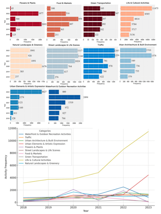
1) What diverse types of human activity can be extracted from social
media data? What specific changes in these activity types are exhibited
as the epidemic progresses?
2) What factors are significantly correlate with urban vitality
regarding human activities, perceived ratings and natural element variables in urban nature?
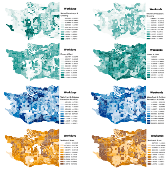
3) How do these key elements affect the spatial and temporal heterogeneity of urban vitality, and what changes in the mechanisms of this
influence have been brought about by the external shocks of COVID-19?
Key Findings
It integrates multi-source data:
It constructs multidimensional indicators
It applies interpretable machine learning models
It identifies spatial and temporal inequalities
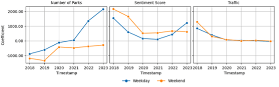
Figures